23,99 €
inkl. MwSt.

Versandfertig in 6-10 Tagen
payback
12 °P sammeln
  • Broschiertes Buch

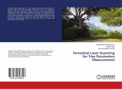
Terrestrial Laser Scanning is a well known technique for deriving an accurate and precise 3D Geo-spatial information. It can be applied in different field of study and research such as forest documentation, building information modeling, topographic survey, civil engineering and construction. This book is written for researchers, post-graduate and under-graduate students to assist them in understanding the basic method on how to capture and process the TLS data (point cloud) for tree parameters measurement. Which can further be used in a large scale environment such as forest.

Produktbeschreibung
Terrestrial Laser Scanning is a well known technique for deriving an accurate and precise 3D Geo-spatial information. It can be applied in different field of study and research such as forest documentation, building information modeling, topographic survey, civil engineering and construction. This book is written for researchers, post-graduate and under-graduate students to assist them in understanding the basic method on how to capture and process the TLS data (point cloud) for tree parameters measurement. Which can further be used in a large scale environment such as forest.
Autorenporträt
Habiba Ibrahim Mohammed ist ein Nigerianer aus dem Bundesstaat Kaduna. Ich wurde am 21/01/89 geboren. Ich habe meinen Bachelor-Abschluss in Geographie an der Ahmadu Bello Universität Zaria, Nigeria, und meinen MSc. Geoinformatik an der Universiti Teknologi Malaysia. Derzeit mache ich meinen Doktor in Geoinformatik an derselben Universiti Teknologi Malaysia.