44,95 €
44,95 €
inkl. MwSt.
Sofort per Download lieferbar
payback
22 °P sammeln
44,95 €
44,95 €
inkl. MwSt.
Sofort per Download lieferbar

Alle Infos zum eBook verschenken
payback
22 °P sammeln
Als Download kaufen
44,95 €
inkl. MwSt.
Sofort per Download lieferbar
payback
22 °P sammeln
Jetzt verschenken
44,95 €
inkl. MwSt.
Sofort per Download lieferbar

Alle Infos zum eBook verschenken
payback
22 °P sammeln
  • Format: PDF

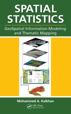
Geospatial information modeling and mapping have become important tools for the investigation and management of natural resources at the landscape scale. This book reviews the types and applications of geospatial information data, such as remote sensing, GIS, and GPS, as well as their integration into landscape-scale geospatial statistical models and maps. Readers will learn the requirements and limitations of each geospatial tool. Along with case studies and statistical data analysis methods, the text includes laboratory exercises using ArcInfo, ArcGIS, ArcView, ERDAS-IMAGINE, and other popular software for geospatial modeling.…mehr

Produktbeschreibung
Geospatial information modeling and mapping have become important tools for the investigation and management of natural resources at the landscape scale. This book reviews the types and applications of geospatial information data, such as remote sensing, GIS, and GPS, as well as their integration into landscape-scale geospatial statistical models and maps. Readers will learn the requirements and limitations of each geospatial tool. Along with case studies and statistical data analysis methods, the text includes laboratory exercises using ArcInfo, ArcGIS, ArcView, ERDAS-IMAGINE, and other popular software for geospatial modeling.

Dieser Download kann aus rechtlichen Gründen nur mit Rechnungsadresse in A, B, BG, CY, CZ, D, DK, EW, E, FIN, F, GR, HR, H, IRL, I, LT, L, LR, M, NL, PL, P, R, S, SLO, SK ausgeliefert werden.

Autorenporträt
Dr. Mohammed A. Kalkhan has over 20 years experience in research and teaching at Colorado State University in Fort Collins, Colorado. As a member of the Natural Resource Ecology Laboratory (NREL) there, he has also served as an affiliate faculty in the Department of Forest, Rangeland, and Watershed Stewardship, and as an advisor for the Interdisciplinary Graduate Certificate in Geospatial Science, Graduate Degree Program in Ecology (GDPE), The School of Global Environmental Sustainability (SOGES), and Department of Earth Resources (currently the Department of Geosciences) at Colorado State University (CSU).

Dr. Kalkhan received his BSc in Forestry (1973) and MSc in Forest Mensuration (1980) from the College of Agriculture and Forestry, the University of Mosul, Iraq. He received his PhD in forest biometrics- remote sensing applications from the Department of Forest Sciences at Colorado State University, USA, in 1994. From 1975 to 1982, he was a lecturer in the Department of Forestry, College of Agriculture and Forestry, University of Mosul. In 1994, he joined the Natural Resource Ecology Laboratory.

Dr. Kalkhan's main interests are in the integration of field data, remote sensing, and GIS with geospatial statistics to understand landscape parameters through the use of a complex model with thematic mapping approaches, including sampling methods and designs, biometrics, determination of uncertainty and mapping accuracy assessment.