59,95 €
59,95 €
inkl. MwSt.
Sofort per Download lieferbar
payback
30 °P sammeln
59,95 €
59,95 €
inkl. MwSt.
Sofort per Download lieferbar

Alle Infos zum eBook verschenken
payback
30 °P sammeln
Als Download kaufen
59,95 €
inkl. MwSt.
Sofort per Download lieferbar
payback
30 °P sammeln
Jetzt verschenken
59,95 €
inkl. MwSt.
Sofort per Download lieferbar

Alle Infos zum eBook verschenken
payback
30 °P sammeln
  • Format: ePub

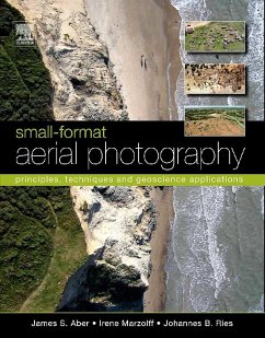
As the need for geographical data rapidly expands in the 21 st century, so too do applications of small-format aerial photography for a wide range of scientific, commercial and governmental purposes. Small-format Aerial Photography (SFAP) presents basic and advanced principles and techniques with an emphasis on digital cameras. Unmanned platforms are described in considerable detail, including kites, helium and hot-air blimps, model airplanes, and paragliders. Several case studies, primarily drawn from the geosciences, are presented to demonstrate how SFAP is actually used in various…mehr

  • Geräte: eReader
  • mit Kopierschutz
  • eBook Hilfe
  • Größe: 50.82MB
Produktbeschreibung
As the need for geographical data rapidly expands in the 21st century, so too do applications of small-format aerial photography for a wide range of scientific, commercial and governmental purposes. Small-format Aerial Photography (SFAP) presents basic and advanced principles and techniques with an emphasis on digital cameras. Unmanned platforms are described in considerable detail, including kites, helium and hot-air blimps, model airplanes, and paragliders. Several case studies, primarily drawn from the geosciences, are presented to demonstrate how SFAP is actually used in various applications. Many of these integrate SFAP with ground-based investigations as well as conventional large-format aerial photography, satellite imagery, and other kinds of geographic information.

  • Full-color photographs throughout
  • Case studies from around the globe
  • Techniques presented allow for image resolution impossible to match via traditional aerial photography or satellite datasets
  • Glossary clarifies key terms

Dieser Download kann aus rechtlichen Gründen nur mit Rechnungsadresse in A, B, BG, CY, CZ, D, DK, EW, E, FIN, F, GR, HR, H, IRL, I, LT, L, LR, M, NL, PL, P, R, S, SLO, SK ausgeliefert werden.

Autorenporträt
Dr. Aber has a PhD in Geology from the University of Kansas. His interests and research experience are wide ranging in geology, tectonics, landscape evolution, wetland environments, remote sensing, aerial photography, and energy resources. He has conducted field investigations across the United States as well as Canada, Scandinavia, Central Europe and Japan. He is a distinguished professor at Emporia State University, Kansas.