65,95 €
65,95 €
inkl. MwSt.
Sofort per Download lieferbar
payback
33 °P sammeln
65,95 €
65,95 €
inkl. MwSt.
Sofort per Download lieferbar

Alle Infos zum eBook verschenken
payback
33 °P sammeln
Als Download kaufen
65,95 €
inkl. MwSt.
Sofort per Download lieferbar
payback
33 °P sammeln
Jetzt verschenken
65,95 €
inkl. MwSt.
Sofort per Download lieferbar

Alle Infos zum eBook verschenken
payback
33 °P sammeln
  • Format: PDF

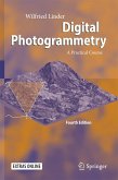
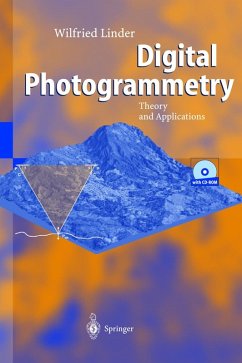
With its combination of explanatory text, complete software (LISA, BLUH) and sample data, this book provides an ideal basis for the study of photogrammetric applications. Written for geographers, cartographers, forest engineers and other experts working with aerial photos, the reader can progress through several tutorials, beginning with a simple example (stereo model). All of the basic functions of digital photogrammetry are explained and worked through: Image orientation, aerial triangulation measurement, bundle block adjustment, feature collection, creation of terrain models, ortho images…mehr

  • Geräte: PC
  • ohne Kopierschutz
  • eBook Hilfe
  • Größe: 16.82MB
Produktbeschreibung
With its combination of explanatory text, complete software (LISA, BLUH) and sample data, this book provides an ideal basis for the study of photogrammetric applications. Written for geographers, cartographers, forest engineers and other experts working with aerial photos, the reader can progress through several tutorials, beginning with a simple example (stereo model). All of the basic functions of digital photogrammetry are explained and worked through: Image orientation, aerial triangulation measurement, bundle block adjustment, feature collection, creation of terrain models, ortho images and mosaics. The CD-ROM contains everything required for training, and the software is not limited to the examples given here.


Dieser Download kann aus rechtlichen Gründen nur mit Rechnungsadresse in A, B, BG, CY, CZ, D, DK, EW, E, FIN, F, GR, HR, H, IRL, I, LT, L, LR, M, NL, PL, P, R, S, SLO, SK ausgeliefert werden.

Autorenporträt
Wilfried Linder, born in 1959, studied mathematics and geography at the University of Hannover (1979-85). Thereafter, he was employed as a scientific assistant at the Universities of Osnabrück/Vechta, Hannover and Düsseldorf. In 1990 he received his Ph.D in geography, followed in 1993 by one in geodesy. He is now a member of the Institute of Geography at the University of Düsseldorf, where he is responsible for the fields of photogrammetry, remote sensing, digital cartography and geo information systems (GIS).