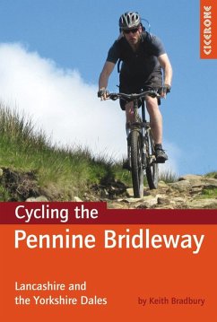
This guidebook covers the northern stages of the Pennine Bridleway, through Lancashire, Yorkshire and Cumbria, a dedicated and waymarked mountain biking and horse-riding trail that opened in 2011. Using part of the Mary Towneley Loop, the route is described for mountain bikers from Summit, just outside Rochdale all the way to Ravenstonedale in Cumbria, in about 176km.
11 circular day mountain bike routes are included for those who do not wish to ride the whole route as a linear trail. It splits the main bridleway into rides of 8 - 16 miles in length.
A grand total of 384km of trail are covered, mapped using OS map extracts and illustrated with profiles, photographed and described in enough detail to suit all levels of navigational ability. Appendices also offer information on local facilities, accommodation, bike shops and other useful contacts for planning your days out or longer trip along the Bridleway, and information provided before each route description includes distance, ascent, grading, estimated time and percentage of route off-road, as well as maps needed and pubs and cafes en route.
Dieser Download kann aus rechtlichen Gründen nur mit Rechnungsadresse in A, D ausgeliefert werden.

