117,95 €
117,95 €
inkl. MwSt.
Sofort per Download lieferbar
payback
59 °P sammeln
117,95 €
117,95 €
inkl. MwSt.
Sofort per Download lieferbar

Alle Infos zum eBook verschenken
payback
59 °P sammeln
Als Download kaufen
117,95 €
inkl. MwSt.
Sofort per Download lieferbar
payback
59 °P sammeln
Jetzt verschenken
117,95 €
inkl. MwSt.
Sofort per Download lieferbar

Alle Infos zum eBook verschenken
payback
59 °P sammeln
  • Format: ePub

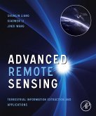
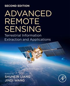
Advanced Remote Sensing: Terrestrial Information Extraction and Applications, Second Edition, is a thoroughly updated application-based reference that provides a single source on the mathematical concepts necessary for remote sensing data gathering and assimilation. It presents state-of-the-art techniques for estimating land surface variables from a variety of data types, including optical sensors like RADAR and LIDAR. The book provides scientists in a number of different fields, including geography, geophysics, geology, atmospheric science, environmental science, planetary science and…mehr

  • Geräte: eReader
  • mit Kopierschutz
  • eBook Hilfe
  • Größe: 405.04MB
Produktbeschreibung
Advanced Remote Sensing: Terrestrial Information Extraction and Applications, Second Edition, is a thoroughly updated application-based reference that provides a single source on the mathematical concepts necessary for remote sensing data gathering and assimilation. It presents state-of-the-art techniques for estimating land surface variables from a variety of data types, including optical sensors like RADAR and LIDAR. The book provides scientists in a number of different fields, including geography, geophysics, geology, atmospheric science, environmental science, planetary science and ecology with access to critically-important data extraction techniques and their virtually unlimited applications.

While rigorous enough for the most experienced of scientists, the techniques presented are well designed and integrated, making the book's content intuitive and practical in its implementation.

  • Provides a comprehensive overview of many practical methods and algorithms
  • Offers descriptions of the principles and procedures of the state-of-the-art in remote sensing
  • Includes real-world case studies and end-of-chapter exercises
  • Contains thoroughly revised chapters, newly developed applications and updated examples

Dieser Download kann aus rechtlichen Gründen nur mit Rechnungsadresse in A, B, BG, CY, CZ, D, DK, EW, E, FIN, F, GR, HR, H, IRL, I, LT, L, LR, M, NL, PL, P, R, S, SLO, SK ausgeliefert werden.

Autorenporträt
Shunlin Liang is Chair Professor at the Department of Geography, University of Hong Kong. His main research interests focus on estimating land surface essential variables from satellite data, global satellite product generation, and global environmental change. He is a Fellow of the IEEE and an Editor-in-Chief of Science of Remote Sensing. He has published over 430 peer-reviewed journal papers, 10 special issues of different journals, and authored/edited eight books. He was also Editor-in-Chief of the nine-volume reference work "Comprehensive Remote Sensing? (Elsevier, 2017) and has led to develop the Global LAnd Surface Satellite (GLASS) products suite and the Hi-GLASS products.

Prof. Wang graduated from Beijing University of Postal and Telecommunications, and received the B.S degree in Electronic Engineering in 1982. She is currently professor of the Research Center for Remote Sensing and GIS of Beijing Normal University. Prof. Wang hosted a number of research projects on remote sensing modeling and validation, land surface parameters retrieval, typical land object's spectrum database establishment, dynamic feature analysis and modeling of remote sensing information, supported by the National Basic Research Program of China, the National High Technology Research and Development Program of China, the National Natural Science Foundation of China.