23,99 €
inkl. MwSt.

Versandfertig in 6-10 Tagen
payback
12 °P sammeln
  • Broschiertes Buch

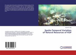
The present study deals with the "Applications of Remote Sensing and GIS for Identification of Spatio-Temporal Variations of Natural Resources of Kudapanakunnu Grama Panchayath and its Land Transformation", undertaken in three phases.In the second phase, the modified thematic maps have been improved with the Google Earth Data Bank and subjected to ArcGIS. In the third phase the derived results have been scrutinized and the variation in all the thematic sectors has been detected and discussed in detail.

Produktbeschreibung
The present study deals with the "Applications of Remote Sensing and GIS for Identification of Spatio-Temporal Variations of Natural Resources of Kudapanakunnu Grama Panchayath and its Land Transformation", undertaken in three phases.In the second phase, the modified thematic maps have been improved with the Google Earth Data Bank and subjected to ArcGIS. In the third phase the derived results have been scrutinized and the variation in all the thematic sectors has been detected and discussed in detail.
Autorenporträt
Ha conseguito la laurea nel 2008 presso l'UNI. DEL KERALA in Geologia, post-laurea nel 2010 presso la BHARATHIDASAN UNI. Ha conseguito il DIPLOMA IN GEOINFORMATICA nel 2010 presso il CENTRO PER L'AMBIENTE E LO SVILUPPO. Nel 2013 ha conseguito un master in TECTONICS ATTIVA E GIS presso l'Università di Delhi. Attualmente sta svolgendo il dottorato di ricerca presso l'Università di Delhi.