17,95 €
inkl. MwSt.
Versandkostenfrei*
Versandfertig in 1-2 Wochen
payback
0 °P sammeln
  • Broschiertes Buch

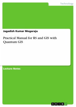
Lecture Notes from the year 2013 in the subject Engineering - General, Basics, grade: GRADUATE, , language: English, abstract: Georeferencing is the process of assigning real-world coordinates to each pixel of the raster. These coordinates are obtained by doing field surveys - collecting coordinates with a GPS device for few easily identifiable features in the image or map. In case of digitize scanned maps, the coordinates can be obtained from the markings on the map image itself. Using these sample coordinates or GCPs (Ground Control Points), the image is warped and made to fit within the chosen coordinate system.…mehr

Produktbeschreibung
Lecture Notes from the year 2013 in the subject Engineering - General, Basics, grade: GRADUATE, , language: English, abstract: Georeferencing is the process of assigning real-world coordinates to each pixel of the raster. These coordinates are obtained by doing field surveys - collecting coordinates with a GPS device for few easily identifiable features in the image or map. In case of digitize scanned maps, the coordinates can be obtained from the markings on the map image itself. Using these sample coordinates or GCPs (Ground Control Points), the image is warped and made to fit within the chosen coordinate system.
Autorenporträt
I am a postgraduate in Biotechnology and Remote sensing & GIS. I am an enthusiastic researcher in interdisciplinary areas comprising of remote sensing/GIS, Climate studies, Biotechnology, Agricultural Science, Hydrology studies and relevant areas.Since my childhood I have generated a zeal towards multidisciplinary concepts and I strongly believe that all the aspects and derivatives of science are interlinked directly or indirectly. Though I am from a poor family, I never let the poorness in my tryst towards excellence and knowing novel objectives of science. I was among a few who is stubborn with the idea of shifting from life science to the advanced technologies such as Remote sensing and GIS though many criticized by my decision. I parallel to my research in the filed of RS/GIS always maintained a strict eye in generating methodologies to achieve food resources and initiate a framework to prepare for the worst if unprecedented environmental issue turns up. I am a strict follower of the saying of Albert Einstein "The true sign of intelligence is not knowledge but imagination".