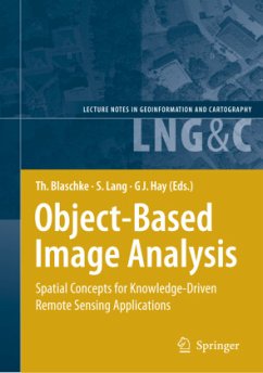
This book addresses the Geographic Information Systems (GIS) and Remote Sensing communities worldwide by presenting a collection of 43 peer-reviewed interdisciplinary perspectives on Object-Based Image Analysis (OBIA). OBIA is a recent sub-discipline of Geographic Information Science devoted to developing automated methods to partition remote sensing imagery into meaningful image-objects, and assessing their characteristics through spatial, spectral and temporal scales. Its applications range from agriculture and natural resource management, to national defense and global climate change. Its economic impact spans from data collection, hardware and software vendors, developers and users, to recipients of sound sustainable environmental policy. Its effect is to synergistically bridge the raster world of remote sensing and the vector world of GIS by generating new semantically rich queryable geographic-information from multiscale earth observation data. We invite you to join us on this exciting state-of-the art journey into OBIA.
This book brings together a collection of invited interdisciplinary persp- tives on the recent topic of Object-based Image Analysis (OBIA). Its c- st tent is based on select papers from the 1 OBIA International Conference held in Salzburg in July 2006, and is enriched by several invited chapters. All submissions have passed through a blind peer-review process resulting in what we believe is a timely volume of the highest scientific, theoretical and technical standards. The concept of OBIA first gained widespread interest within the GIScience (Geographic Information Science) community circa 2000, with the advent of the first commercial software for what was then termed 'obje- oriented image analysis'. However, it is widely agreed that OBIA builds on older segmentation, edge-detection and classification concepts that have been used in remote sensing image analysis for several decades. Nevert- less, its emergence has provided a new critical bridge to spatial concepts applied in multiscale landscape analysis, Geographic Information Systems (GIS) and the synergy between image-objects and their radiometric char- teristics and analyses in Earth Observation data (EO).
This book brings together a collection of invited interdisciplinary persp- tives on the recent topic of Object-based Image Analysis (OBIA). Its c- st tent is based on select papers from the 1 OBIA International Conference held in Salzburg in July 2006, and is enriched by several invited chapters. All submissions have passed through a blind peer-review process resulting in what we believe is a timely volume of the highest scientific, theoretical and technical standards. The concept of OBIA first gained widespread interest within the GIScience (Geographic Information Science) community circa 2000, with the advent of the first commercial software for what was then termed 'obje- oriented image analysis'. However, it is widely agreed that OBIA builds on older segmentation, edge-detection and classification concepts that have been used in remote sensing image analysis for several decades. Nevert- less, its emergence has provided a new critical bridge to spatial concepts applied in multiscale landscape analysis, Geographic Information Systems (GIS) and the synergy between image-objects and their radiometric char- teristics and analyses in Earth Observation data (EO).

