159,99 €
inkl. MwSt.
Versandkostenfrei*
Versandfertig in über 4 Wochen
payback
80 °P sammeln
  • Broschiertes Buch

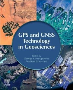
"GPS and GNSS Technology in Geosciences offers an interdisciplinary approach to applying advances in GPS/GNSS technology for geoscience research and practice. As GPS/GNSS signals can be used to provide useful information about the Earth's surface characteristics and land surface composition, GPS equipment and services for commercial purposes continues to grow, thus resulting in new expectations and demands. This book provides case studies for a deeper understanding of the operation and principles of widely applied approaches and the benefits of the technology in everyday research and activities."--Publisher marketing.…mehr

Produktbeschreibung
"GPS and GNSS Technology in Geosciences offers an interdisciplinary approach to applying advances in GPS/GNSS technology for geoscience research and practice. As GPS/GNSS signals can be used to provide useful information about the Earth's surface characteristics and land surface composition, GPS equipment and services for commercial purposes continues to grow, thus resulting in new expectations and demands. This book provides case studies for a deeper understanding of the operation and principles of widely applied approaches and the benefits of the technology in everyday research and activities."--Publisher marketing.
Autorenporträt
George P. Petropoulos obtained his PhD from King's College London in the United Kingdom. Currently, he is Assistant Professor of Geoinformatics at the Dept. of Geography, Harokopio University of Athens, Greece. He also holds a Marie Curie Fellowship with the School of Mineral Resources Engineering of the Technical University of Crete, Greece (2018-2021). His research focuses on the use of Earth Observation, Geographical Information Systems (GIS), digital cartography, GPS, simulation process models, ground measurement networks in geographical and environmental applications. His main research interests include the mapping of the natural and man-made environment and monitoring of their changes over time, the study of biotic and abiotic hazards and of their spatiotemporal dynamics, the development of geoinformation software tools and use of operational products and applications of geoinformation.