GIS &Remote Sensing based Water Quality Assessment in-relation
to Land use/land Cover Patterns
Versandkostenfrei!
Versandfertig in 6-10 Tagen
32,99 €
inkl. MwSt.

PAYBACK Punkte
16 °P sammeln!
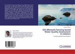
GIS and Remote Sensing are powerful tools on analyzing land use/ land cover change of a given place. Different studies have shown that in watershed, land use land cover change have direct impact on determining water quality, and this remains to be true in the analysis done for Hashengea watershed system. In this study, land use land cover change classification for the periods 1985, 1995 and 2011 were analyzed using Landsat 4 TM with 30x30 meter resolution using ArcGIS and ERDAS IMAGEN environment. The water samples taken from the lake for analysis have indicated that most of them have excessiv...
GIS and Remote Sensing are powerful tools on analyzing land use/ land cover change of a given place. Different studies have shown that in watershed, land use land cover change have direct impact on determining water quality, and this remains to be true in the analysis done for Hashengea watershed system. In this study, land use land cover change classification for the periods 1985, 1995 and 2011 were analyzed using Landsat 4 TM with 30x30 meter resolution using ArcGIS and ERDAS IMAGEN environment. The water samples taken from the lake for analysis have indicated that most of them have excessively concentrated above the maximum allowable concentrations recommended by different organization on the lake, with a causes related to run-off from agricultural land, grazing land and urban areas. As a result this could have negative implication on the current practice management of the lake. This book therefore, provides a new metric of success for environmentalists, regional planers, agricultural experts and the surrounding communities who utilize on the water from the lake for different communities who utilize on the water from the lake for different uses.


