23,99 €
inkl. MwSt.

Versandfertig in 6-10 Tagen
payback
12 °P sammeln
  • Broschiertes Buch

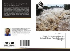
The "Flash Flood Spatial Analysis Using GIS and Remote Sensing Techniques" is a readable text that presents basic concepts and practical material in each of the areas remote sensing and Geographic information system. It is written primarily for students and researchers who are interested in studying flash flood using satellite images. The book contains a case study in Najran city, KSA. Although the book has descriptions of some software such as ArcGIS and Hec-Ras which are used to get water surface during any flash flood event. Moreover, it contains how to use SAR images to calibrate obtained results from Hydrology investigations.…mehr

Produktbeschreibung
The "Flash Flood Spatial Analysis Using GIS and Remote Sensing Techniques" is a readable text that presents basic concepts and practical material in each of the areas remote sensing and Geographic information system. It is written primarily for students and researchers who are interested in studying flash flood using satellite images. The book contains a case study in Najran city, KSA. Although the book has descriptions of some software such as ArcGIS and Hec-Ras which are used to get water surface during any flash flood event. Moreover, it contains how to use SAR images to calibrate obtained results from Hydrology investigations.
Autorenporträt
Ismail Elkhrachy Born in Egypt 1968, holds a Ph.D. in Surveying Engineering 2008 (Institute of Geodesy and Photogrammetry, Technical University Braunschweig, Germany). His B.Sc. and M.Sc. in Civil Engineering Department, Al-Azhar University, Cairo, Egypt. Currently, working as Assistance Professor, College of Engineering, Najran University, KSA.