26,99 €
inkl. MwSt.
Versandkostenfrei*
Versandfertig in 6-10 Tagen
payback
13 °P sammeln
  • Broschiertes Buch

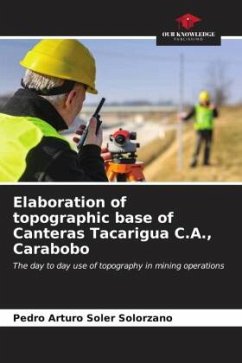
The progress of the mining works of Canteras Tacarigua C.A. has caused that the topographic base used is outdated, therefore, the terrain is not adequately represented, generating greater uncertainty in the calculations and interpretations made with it, for this reason, it was proposed to develop a topographic base with the use of geodetic satellite positioning system (GPS) and post-processing methods in the center of operations of Canteras Tacarigua, Mar Azul sector, Puerto Cabello municipality, Carabobo state.

Produktbeschreibung
The progress of the mining works of Canteras Tacarigua C.A. has caused that the topographic base used is outdated, therefore, the terrain is not adequately represented, generating greater uncertainty in the calculations and interpretations made with it, for this reason, it was proposed to develop a topographic base with the use of geodetic satellite positioning system (GPS) and post-processing methods in the center of operations of Canteras Tacarigua, Mar Azul sector, Puerto Cabello municipality, Carabobo state.
Autorenporträt
Engenheiro de minas com conhecimentos no planeamento de trabalhos mineiros a curto, médio e longo prazo de jazidas metálicas e não metálicas.