26,99 €
inkl. MwSt.
Versandkostenfrei*
Versandfertig in 6-10 Tagen
payback
13 °P sammeln
  • Broschiertes Buch

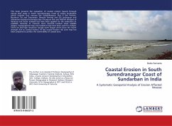
This book presents the evaluation of coastal erosion hazard through mouza level study in South Surendranagar Coast of Indian Sundarban which includes four mouzas like Gobardhanpur, Plot G 6th Portion, Buraburir Tat and Sitarampur. Remote Sensing and GIS techniques and inferential statistical techniques like Chi-square test and ANOVA (Analysis of Variance one factor analysis) test have been applied for the evaluation to establish rationale of research more scientific. Landsat series satellite images, Topographical map and Cadastral map have been used for analysis. There are also high resolution…mehr

Produktbeschreibung
This book presents the evaluation of coastal erosion hazard through mouza level study in South Surendranagar Coast of Indian Sundarban which includes four mouzas like Gobardhanpur, Plot G 6th Portion, Buraburir Tat and Sitarampur. Remote Sensing and GIS techniques and inferential statistical techniques like Chi-square test and ANOVA (Analysis of Variance one factor analysis) test have been applied for the evaluation to establish rationale of research more scientific. Landsat series satellite images, Topographical map and Cadastral map have been used for analysis. There are also high resolution Google earth images which show the recent changes due to coastal erosion. At last coastal erosion risk zone map has been prepared to predict the vulnerability of coastal area.
Autorenporträt
O autor é Professor Assistente (Geografia) do Vidyasagar Teachers Training Institute, Sanjua, W.B., Índia; Professor Convidado (Geografia) no Muralidhar Girls' College, Calcutá. Também actuou como Pessoa de Recursos (Geografia) na Diamond Harbour Women's University. Mestre em Geografia (2011) e Mestre em Educação (2015) pela Universidade de Calcutá.