19,99 €
inkl. MwSt.

Versandfertig in über 4 Wochen
payback
10 °P sammeln
  • Broschiertes Buch

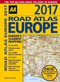
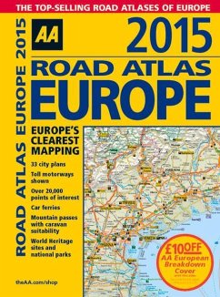
Fully revised and updated for 2015, this specialist A4 road atlas designed for the British motorist in Europe, with multi-scale mapping of 46 countries. The atlas includes information on national speed limits, toll-free motorways, car ferries, mountain passes with caravan suitability, emergency telephone numbers, and road distances, together with national parks and many other places of interest. 14.2 miles to 1 inch, 1:900,000 (main scale), but please note some areas are at a smaller scale.

Produktbeschreibung
Fully revised and updated for 2015, this specialist A4 road atlas designed for the British motorist in Europe, with multi-scale mapping of 46 countries. The atlas includes information on national speed limits, toll-free motorways, car ferries, mountain passes with caravan suitability, emergency telephone numbers, and road distances, together with national parks and many other places of interest. 14.2 miles to 1 inch, 1:900,000 (main scale), but please note some areas are at a smaller scale.

Autorenporträt
AA Publishing is the UK's biggest travel publisher and one of the top 10 worldwide.