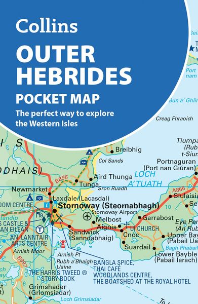
Outer Hebrides Pocket Map The Perfect Way to Explore the Western Isles
-
- Englisch ausgewählt
5,99 €
inkl. gesetzl. MwSt.,
Beschreibung
Produktdetails
Einband
Karte
Erscheinungsdatum
08.04.2027
Abbildungen
Index
Verlag
Collins ELTSeitenzahl
1
Maße (L/B/H)
14/9/2,1 cm
Gewicht
270 g
Auflage
3 Revised edition
Sprache
Englisch
ISBN
978-0-00-885003-6
Explore new places with handy pocket maps from Collins.
Handy little full-colour map of the Western Isles of Scotland. Detailed mapping and tourist information for the islands of Lewis, Harris, Uist, Benbecula, Barra and St Kilda. Excellent value and very detailed for its size.
Famed for its stunning coastline, wildlife and traditional food and drink, the Outer Hebrides have a distinct identity. Discover these unique islands with this handy pocket map.
Main features of this map include:
¿ Clear mapping at a scale of 3.2 miles to 1 inch
¿ Tourist attractions located and described
¿ Sights, places to stay, cafe/restaurant, things to do are all highlighted on the map
¿ Transport links map showing how to get to and depart the islands
¿ Index to places of interest and place names
Essential for those planning a trip around the Western Isles.
Noch keine Bewertungen vorhanden
Verfassen Sie die erste Bewertung zu diesem Artikel
Helfen Sie anderen Kundinnen und Kunden durch Ihre Meinung.
Kurze Frage zu unserer Seite
Vielen Dank für dein Feedback
Wir nutzen dein Feedback, um unsere Produktseiten zu verbessern. Bitte habe Verständnis, dass wir dir keine Rückmeldung geben können. Falls du Kontakt mit uns aufnehmen möchtest, kannst du dich aber gerne an unseren Kund*innenservice wenden.
zum Kundenservice