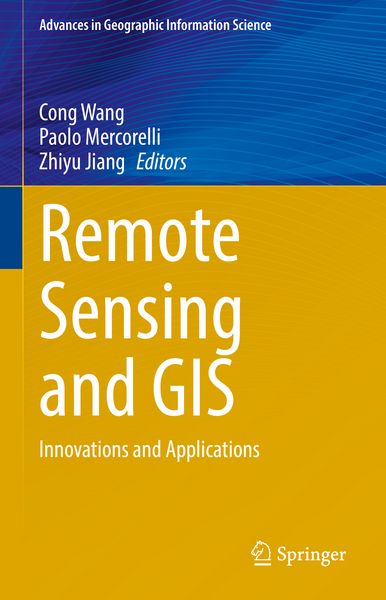
Produktbild: Remote Sensing and GIS
- 10%

Remote Sensing and GIS Innovations and Applications

10% sparen

171,99 € UVP 192,59 €

inkl. gesetzl. MwSt., Versandkostenfrei

Lieferung nach Hause

Beschreibung

Produktdetails

Einband

Gebundene Ausgabe

Erscheinungsdatum

05.05.2026

Abbildungen

X, 195 illus., 181 illus. in color., farbige Illustrationen, schwarz-weiss Illustrationen

Herausgeber

Cong Wang + weitere

Verlag

Springer

Seitenzahl

473

Maße (L/B/H)

24,1/16/3 cm

Gewicht

973 g

Sprache

Englisch

ISBN

978-3-032-07947-3

Beschreibung

Portrait

Dr. Cong Wang is currently an Associate Professor in the School of Mathematics and Statistics at Northwestern Polytechnical University, China. He received Ph.D. degree in mechatronic engineering from School of Mechano-Electronic Engineering from Xidian University and completed joint training at the University of Alberta, Nanyang Technological University, and the National University of Singapore. His primary research focuses on complex-domain image analysis and processing, as well as mathematical foundations of artificial intelligence. Over the past five years, he has led over ten research projects and published more than forty academic papers as first or corresponding author. He serves as editorial board member for over ten international journals and has held program committee chair, publication chair, and session chair roles in more than thirty international conferences. Dr. Wang is a member of several professional societies including Institute of Electrical and Electronics Engineers, Chinese Association of Automation, China Computer Federation, China Society for Industrial and Applied Mathematics , Chinese Association for Artificial Intelligence, and China Society of Image and Graphics.


Dr. Paolo Mercorelli received the Ph.D. degree in systems engineering from the University of Bologna in 1998 after a visiting year at UC Santa Barbara. Post-doctoral work followed at ABB Corporate Research in Heidelberg (1998-2001). Leading the control group at Wernigerode’s Institute of Automation and Informatics (2002-2005), he subsequently served as Associate Professor of process informatics at Ostfalia University (2005-2011). Since 2012 he holds a Distinguished Full Professorship and Chair of Control and Drive Systems at Leuphana University’s Institute of Product and Process Innovation; since 2018 he is International Distinguished Visiting Professor at Lodz University of Technology. Research focuses on Kalman filtering applications, robotics, wavelets, geometric control and sliding-mode techniques. Recipient of a Marie Curie Fellowship (1998), he has garnered seven best-paper awards at major conferences and ranks among Elsevier-Stanford’s top-2% scientists (2019-2022).


Dr. Zhiyu Jiang is an Associate Professor at the School of Artificial Intelligence, Optics and Electronics, Northwestern Polytechnical University. His research focuses on unmanned systems and visual perceptual computing. He has published over twenty papers in international journals and conferences, with several ESI Highly Cited Papers and IEEE Best Paper Award recipients. Dr. Jiang holds more than ten authorized or applied national invention patents. He earned his Ph.D. in signal and information processing from the University of Chinese Academy of Sciences in 2018. Over the past five years, he has led eight national and provincial vertical projects and four industry collaboration projects. Dr. Jiang has served extensively as Guest Editor for international journals and as Program Co-Chair, Program Committee Chair, and Track Chair for numerous international conferences.

Produktdetails

Einband

Gebundene Ausgabe

Erscheinungsdatum

05.05.2026

Abbildungen

X, 195 illus., 181 illus. in color., farbige Illustrationen, schwarz-weiss Illustrationen

Herausgeber

Verlag

Springer

Seitenzahl

473

Maße (L/B/H)

24,1/16/3 cm

Gewicht

973 g

Sprache

Englisch

ISBN

978-3-032-07947-3

Herstelleradresse

Springer-Verlag KG
Sachsenplatz 4-6
1201 Wien
AT

Email: GPSR Kontakt

Noch keine Bewertungen vorhanden

Verfassen Sie die erste Bewertung zu diesem Artikel

Helfen Sie anderen Kundinnen und Kunden durch Ihre Meinung.

Kundinnen und Kunden meinen

Bewertungen (0)

  • Produktbild: Remote Sensing and GIS
  • 1 Multi-Factor Clustering Model-Driven Assessment of Natural Forest Stand Characteristics and Succession Stages: A Case Study in Hubei Province.- 2 Research on the Impact of the South to North Water Diversion Middle Route Project on Vegetation Coverage in the Hanjiang River Basin.- 3 Inversion and Analysis of the Long-Term Fraction Vegetation Coverage in a Typical Open-Pit Coal Mine.- 4 Spatiotemporal Evolution of Vegetation and Its Driving Impacts in the Ordos, China.- 5 Spatial and Temporal Characteristics Analysis of Soil Erosion in the Fanchang of Wuhu City from 1990 to 2022.- 6 Research on Digital Modeling and Information Expression of Historical Buildings.- 7 Development Suitability Evaluation of Low Hill and Gentle Slope Lands in Jianyang Central Urban Area of Nanping City Based on Resource-Environmental Carrying Capacity.- 8 Assimilation of ASTER Observations for Regional Scale Soil Moisture Estimation Using Ensemble Kalman Filter.- 9 Glacier Lake Boundary Extraction Based on Composite Remote Sensing Indices.- 10 Research on Water Column Correction for Submerged Vegetation Reflectance Based on a Semi-Analytical Model.- 11 Extraction of Weak Alteration Mineral Information Based on Landsat 8 and Zhuhai-1 Satellite Data: A Case Study of Zijinshan Copper Polymetallic Ore Field in Fujian.- 12 Lake Surface Area Variations and Climate Change Characteristics of Bankog Co in Tibet over the Past 50 Years.- 13 Estimation of Urban Forest Aboveground Biomass Using Terrestrial Mobile LiDAR.- 14 Research on Urban On-road CO2 Emissions Based on Mobile Monitoring: A Case Study of Wuhan.- 15 Analysis of Changes in Ecosystem Services and Trade-off Synergies in East Malaysia over 30 years.- 16 Changes in Landscape Pattern and Ecological Risk Assessment of Coastal Areas of Malaysian Peninsula.- 17 Spatial Heterogeneity of Air Quality in Greater Manchester: Impact of Land Use and Green Spaces.- 18 Temporal and Seasonal Variations in Air Quality in Greater Manchester (2010-2020).- 19 Estimation of Aboveground Biomass in Urban Forests of Guilin City.- 20 Evaluation of Predictive Modeling Based on N-VS Modeling of Geological Features: A Case Study of Cement Plant in Java, Indonesia.- 21 Study on the Mechanism and Control Measures of Open-pit Mine Landslide Controlled by Weak Layer.- 22 Spatiotemporal Co-seismic and Post-seismic Deformation Analysis of 2021 Maduo Mw7.4 Earthquake in China by Using Sentinel-1 SAR Images.- 23 PS-InSAR-Based Monitoring and Analysis of Ground Subsidence in the Wudaoliang Section of the Qinghai-Tibet Highway.- 24 The Application of Geological Hazard Monitoring and Early Warning Systems in Disaster Prevention and Mitigation.- 25 Surface Subsidence Monitoring in the Main Urban and Typical Areas of Jinan City.- 26 Sedimentary Paleogeographic Characteristics of the First Member of Maokou Formation in the Middle Permian, Sichuan Basin.- 27 Reliability Analysis of Reservoir Bank Slope Stability Based on the Monte Carlo Method.- 28 The Morphological Evolution of the Middle and Downstream Sections of the Keriya River in the Past 20 Years.- 29 Oil Spill Detection in the Bohai Sea Based on Marine Landscape Patterns.- 30 Research on Near-Surface CH4 Concentration Estimation Method Based on Machine Learning and Remote Sensing Information.- 31 Wavelength selection study for ozone measurement by DIAL.- 32 Development of a Marine 3D Spatiotemporal Database and Platform.- 33 Carbon Storage Estimation of Natural Resource Elements Based on Remote Sensing Technology.- 34 Ground-Based InSAR Technique for Monitoring Two-Dimensional Deformation of Slopes.- 35 Evaluation of Mine Geological Environment in Binzhou City Using Analytic Hierarchy Process and Entropy Weight Method.- 36 Oil Spill Detection and Intensity Assessment in the Bohai Sea Using Sentinel-1 Data.