Schade – dieser Artikel ist leider ausverkauft. Sobald wir wissen, ob und wann der Artikel wieder verfügbar ist, informieren wir Sie an dieser Stelle.
  • Format: ePub

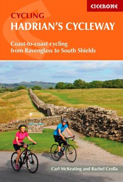
Guidebook to Hadrian's Cycleway, a waymarked cycle route that traces what was the most northerly frontier of the Roman Empire. This 174-mile (280km) coast-to-coast route from Ravenglass in Cumbria to South Shields follows quiet roads and cycle paths and can be ridden by cyclists of all abilities.
Suggested route takes three days with stages of 5364 miles (85103km) | Also includes more leisurely four- and five-day options, a 100-mile (161km) two-day cycle tour along Hadrian's Wall only, and an alternative stage that rides closer to the Wall than the official route | Clear route descriptions
…mehr

  • Geräte: eReader
  • mit Kopierschutz
  • eBook Hilfe
  • Größe: 18.59MB
Produktbeschreibung
Guidebook to Hadrian's Cycleway, a waymarked cycle route that traces what was the most northerly frontier of the Roman Empire. This 174-mile (280km) coast-to-coast route from Ravenglass in Cumbria to South Shields follows quiet roads and cycle paths and can be ridden by cyclists of all abilities.

  • Suggested route takes three days with stages of 5364 miles (85103km)
  • Also includes more leisurely four- and five-day options, a 100-mile (161km) two-day cycle tour along Hadrian's Wall only, and an alternative stage that rides closer to the Wall than the official route
  • Clear route descriptions with 1:100,000 mapping, city-centre detail maps and elevation profiles
  • The main route is described from west-east, but includes descriptions for riding east-west
  • Includes facilities listings, local history, travel to and from the start and finish, and advice on preparing your kit, bike and self for the adventure
  • Highlights include Ravenglass, Whitehaven, Solway Coast and AONB, Carlisle Castle, Lanercost Priory, Hexham, Tyne Bridge, Roman forts of Birdoswald, Vindolanda, Housesteads, Chesters
  • GPX files for all route variants available for download

Dieser Download kann aus rechtlichen Gründen nur mit Rechnungsadresse in A, D ausgeliefert werden.
Autorenporträt
Rachel Crolla is an outdoors all-rounder who loves hiking, biking, scrambling and climbing. She grew up in Yorkshire, where she still lives with her partner Carl McKeating and their young family. Rachel is an outdoors writer and photographer who is also trained as a journalist and teacher. She has hiked and climbed across the UK, Europe and the USA. In 2007 Rachel became the first woman to reach the summit of every country in Europe - she co-wrote the Cicerone guide book Europe's High Points soon afterwards. Rachel has since co-written a guide to the mountains of the Massif Central in France and more recently has enjoyed writing about areas in the UK. She and Carl fully updated the Cicerone guide book Scrambles in Snowdonia , which was originally written by Steve Ashton in 1980. Rachel's first cycling guide to the Yorkshire and Lancashire-based Way of the Roses was published in 2018. Rachel and Carl are passionate about enthusing the next generation of hikers and cyclists with a love of the outdoors.