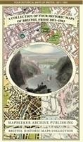
A Bristol 1851-1903 - Fold up Map that consists of Four Detailed Street Plans, Bristol 1851 by John Tallis, 1866 by A Fullarton, 1893 by William MacKenzie and 1903 by Bartholomew.
Versandfertig in 2-4 Wochen
28,99 €
inkl. MwSt.

PAYBACK Punkte
14 °P sammeln!
This folded map (890mm x 1000mm) is an ideal souvenir for tourists to Bristol and also a valuable reference resource for local and family history research. It includes 4 Historic maps of Bristol, J. Bartholomew 1903, W. Mackenzie 1893, J. Tallis 1851, A. Fullarton 1866.The maps are very detailed and show the towns and villages from the period.


