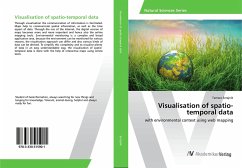
Visualisation of spatio-temporal data
with environmental context using web mapping
Versandkostenfrei!
Versandfertig in 6-10 Tagen
53,99 €
inkl. MwSt.

PAYBACK Punkte
27 °P sammeln!
Through visualisation the communication of information is facilitated. Maps help to communicate spatial information, as well as the time aspect of data. Through the rise of the Internet, the digital version of maps becomes more and more important and hence also the online mapping tools. Environmental monitoring is a complex and broad application area, because the environment can be monitored for various reasons, the visualisation approach can differ and also various kinds of data can be derived. To simplify this complexity and to visualise plenty of data in an easy understandable way, the visu...
Through visualisation the communication of information is facilitated. Maps help to communicate spatial information, as well as the time aspect of data. Through the rise of the Internet, the digital version of maps becomes more and more important and hence also the online mapping tools. Environmental monitoring is a complex and broad application area, because the environment can be monitored for various reasons, the visualisation approach can differ and also various kinds of data can be derived. To simplify this complexity and to visualise plenty of data in an easy understandable way, the visualisation of spatio-temporal data is done with the help of interactive maps using online tools.


