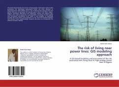
The risk of living near power lines: GIS modeling approach
A GIS-based modeling and assessment of the risk associated with living close to high-voltage power lines in Nigeria
Versandkostenfrei!
Versandfertig in 6-10 Tagen
27,99 €
inkl. MwSt.

PAYBACK Punkte
14 °P sammeln!
This book demonstrates the power of Geographic Information System (GIS) techniques for identifying populations which are both exposed to Electromagnetic Fields (EMFs) and at risk of electrocution because they live within the zone of potential risk around power lines in the Benin region, Nigeria. GIS-based algorithms such buffering, overlay and address geo-coding were used to generate a geo-database consisting of both spatial and non-spatial information from which it was possible to holistically visualize the areal extent and population at risk. Such GIS-assisted database will enhance future ep...
This book demonstrates the power of Geographic Information System (GIS) techniques for identifying populations which are both exposed to Electromagnetic Fields (EMFs) and at risk of electrocution because they live within the zone of potential risk around power lines in the Benin region, Nigeria. GIS-based algorithms such buffering, overlay and address geo-coding were used to generate a geo-database consisting of both spatial and non-spatial information from which it was possible to holistically visualize the areal extent and population at risk. Such GIS-assisted database will enhance future epidemiologic research and serve as a framework for effective decision making.


