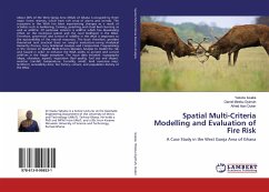
Spatial Multi-Criteria Modelling and Evaluation of Fire Risk
A Case Study in the West Gonja Area of Ghana
Versandkostenfrei!
Versandfertig in 6-10 Tagen
38,99 €
inkl. MwSt.

PAYBACK Punkte
19 °P sammeln!
About 30% of the West Gonja Area (WGA) of Ghana is occupied by three major forest reserves, which have rich array of plants and animals. The ecosystem in the WGA has been experiencing changes as a result of activities such as lumbering, farming, poaching and ritual bush burning as well as wildfire. Of particular concern is wildfire which has devastating effect on the ecological system and the rural livelihood in the WGA. Therefore, prevention and control of wildfire in the WGA is important to the sustainability of the natural resources. This book therefore, provides theoretical and practical b...
About 30% of the West Gonja Area (WGA) of Ghana is occupied by three major forest reserves, which have rich array of plants and animals. The ecosystem in the WGA has been experiencing changes as a result of activities such as lumbering, farming, poaching and ritual bush burning as well as wildfire. Of particular concern is wildfire which has devastating effect on the ecological system and the rural livelihood in the WGA. Therefore, prevention and control of wildfire in the WGA is important to the sustainability of the natural resources. This book therefore, provides theoretical and practical basis on weight evaluations using: Analytical Hierarchy Process, Grey Relational Analysis and Compromise Programming in the context of Spatial Multi-Criteria Decision Analysis to model fire risk and hazard in order to enhance the WGA ability to prevent and control wildfires in the fragile ecosystem. The input data included: topography (slope, elevation, aspect); vegetation (fuel quality, fuelsize and shape); weather (rainfall, temperature, humidity, wind); land cover/use map; landform; accessibility data; fire history; culture; and population density of the WGA.


