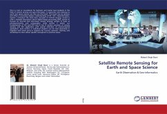
Satellite Remote Sensing for Earth and Space Science
Earth Observation & Geo-informatics
Versandkostenfrei!
Versandfertig in 6-10 Tagen
65,99 €
inkl. MwSt.

PAYBACK Punkte
33 °P sammeln!
This is a text or coursebook for bachelor and master level students in the field of remote sensing and geo-informatics. A researcher who belongs to earth and space science can also use this book. This book has six sections and offers a successive deeper understanding of RS / GIS / Geoinformatics. Section I introduce the most basic concepts of remote sensing; section II offer a detailed description about digital image processing (DIP); section III focuses on thermal and microwave remote sensing; section IV looks at photogrammetry and cartography; while section V sketch out fundamentals of GIS a...
This is a text or coursebook for bachelor and master level students in the field of remote sensing and geo-informatics. A researcher who belongs to earth and space science can also use this book. This book has six sections and offers a successive deeper understanding of RS / GIS / Geoinformatics. Section I introduce the most basic concepts of remote sensing; section II offer a detailed description about digital image processing (DIP); section III focuses on thermal and microwave remote sensing; section IV looks at photogrammetry and cartography; while section V sketch out fundamentals of GIS and GPS and in last VI section overview of remote sensing and GIS application with special attention of environmental application. Each section or individual chapters can be read separately or together with other parts or chapters for courses, seminars, training, and workshops to learn about specific conceptual or practical issues.


