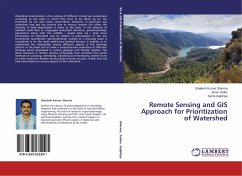
Remote Sensing and GIS Approach for Prioritization of Watershed
Versandkostenfrei!
Versandfertig in 6-10 Tagen
36,99 €
inkl. MwSt.

PAYBACK Punkte
18 °P sammeln!
Watershed prioritization is the ranking of different critical sub watersheds according to the order in which they have to be taken up for the treatment by soil and water conservation measures. A particular sub watershed may get top priority due to various reasons but often the intensity of land degradation is taken as the basis. In the absence of sediment yield data or ungauged watershed situations, geomorphologic parameters along with the satellite - based land use / land cover information of watershed may be helpful in prioritization of the sub watersheds. Quantitative geomorphologic analysi...
Watershed prioritization is the ranking of different critical sub watersheds according to the order in which they have to be taken up for the treatment by soil and water conservation measures. A particular sub watershed may get top priority due to various reasons but often the intensity of land degradation is taken as the basis. In the absence of sediment yield data or ungauged watershed situations, geomorphologic parameters along with the satellite - based land use / land cover information of watershed may be helpful in prioritization of the sub watersheds. Quantitative geomorphologic analysis of a drainage basin is considered to be the most satisfactory method because it enables us to understand the relationship among different aspects of the drainage pattern of the basin and to make a comprehensive evaluation of different drainage basins developed in various geologic and climatic regimes. The latest advances in remote sensing technology have provided very useful methods of surveying, identifying, classifying and monitoring several forms of earth resources. Remote sensing data provide accurate, timely and real time information on various aspects of the watershed.


