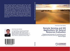
Remote Sensing and GIS Applications for Natural Resources Evaluation
Mapping And Evaluation Of Land Resources By Integration Of Remote Sensing And GIS (Wadi El-Natroun-Egypt)
Versandkostenfrei!
Versandfertig in 6-10 Tagen
36,99 €
inkl. MwSt.

PAYBACK Punkte
18 °P sammeln!
Remote sensing (RS), Geographic Information Systems (GIS) and Global Positioning System (GPS) are modern technologies for data acquire, storage, processing, analysis, management and generate these data in large quantities and high quality. The integration between these modern tools (RS, GIS and GPS) has a large scale of applications in different fields including agriculture sector. Land evaluation is an essential tool for land use planning and it contains a lot of concepts like soil capability, soil suitability and soil productivity. In this book, the author explains the fundamental concepts o...
Remote sensing (RS), Geographic Information Systems (GIS) and Global Positioning System (GPS) are modern technologies for data acquire, storage, processing, analysis, management and generate these data in large quantities and high quality. The integration between these modern tools (RS, GIS and GPS) has a large scale of applications in different fields including agriculture sector. Land evaluation is an essential tool for land use planning and it contains a lot of concepts like soil capability, soil suitability and soil productivity. In this book, the author explains the fundamental concepts of Remote Sensing, GIS, GPS and land evaluation and he used their applications in a case study for mapping soil physical and chemical characteristics, digital elevation model for soil surface, land use, soil suitability and soil erosion of study area. The main objectives of this case study are: Building up a digital georeferenced database in GIS environment, Utilize the availability of remotely-sensed imagery to mapping soils for the study area and evaluate the suitability of this soils for some selected crops.


