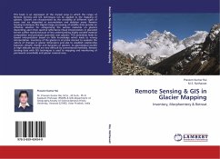
Remote Sensing & GIS in Glacier Mapping
Inventory, Morphomtery & Retreat
Versandkostenfrei!
Versandfertig in 6-10 Tagen
36,99 €
inkl. MwSt.

PAYBACK Punkte
18 °P sammeln!
This book is an expression of the myriad ways in which the range of Remote Sensing and GIS techniques can be applied to the mapping of glaciers. Glaciers are characterized by the variability of different types of snow and ice deposited in accumulation and ablation areas. Remote Sensing techniques like Digital image processing of satellite data provide an effective solution for categorizing the various materials on glaciers depending upon their spectral reflectance.Visual interpretation in glaciated terrain suffers mainly because of less understanding highly variable material composition and pr...
This book is an expression of the myriad ways in which the range of Remote Sensing and GIS techniques can be applied to the mapping of glaciers. Glaciers are characterized by the variability of different types of snow and ice deposited in accumulation and ablation areas. Remote Sensing techniques like Digital image processing of satellite data provide an effective solution for categorizing the various materials on glaciers depending upon their spectral reflectance.Visual interpretation in glaciated terrain suffers mainly because of less understanding highly variable material composition and processes operative over glaciers. This sometimes leads to biased interpretation based on little knowledge which leads to wrong interpretation. Inventory of the glaciers is of prime interest to evaluate the nature of changes in glacier dimensions and also to establish relationship between climatic change and dynamics of glaciers. As glaciological studies in high altitude terrains are very difficult by conventional methods. Remote Sensing data with GIS techniques is used to mapping and monitoring of permanent snowfields and glacier covered area.


