Preliminary Satellite Image Analysis
Processing the Landsat Imagery Inside the ArcGIS Setting
Versandkostenfrei!
Versandfertig in 1-2 Wochen
54,99 €
inkl. MwSt.

PAYBACK Punkte
27 °P sammeln!
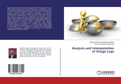
The current practical course-book is designed to initiate graduate students and young researchers' knowledge on the satellite image analysis subject matters and it is broken into four sections. In each section, learners have been provided with four lessons, each to be used by beginner and intermediate geography and environment MS and Ph.D. students within the framework of the ArcGIS software capacity offering many strong image analysis components. ArcGIS 10.5 or any level, and the Spatial Analyst Extension is required to use this tutorial. Hence, learners should be proficient in the basic func...
The current practical course-book is designed to initiate graduate students and young researchers' knowledge on the satellite image analysis subject matters and it is broken into four sections. In each section, learners have been provided with four lessons, each to be used by beginner and intermediate geography and environment MS and Ph.D. students within the framework of the ArcGIS software capacity offering many strong image analysis components. ArcGIS 10.5 or any level, and the Spatial Analyst Extension is required to use this tutorial. Hence, learners should be proficient in the basic functions of ArcGIS including creating a new project and geodatabase, setting up a project workspace, editing data, adding and using the dockable windows. They will learn how to set ArcMap, ArcCatalog and ArcToolbox dropdown and menu tabs, and most of the functionality of the Image Analysis window. Each lesson explains ArcGIS workflow in detail; and this is an opportunity for every learner to become familiar with the tremendous tools and functions available, particularly dealing with the Republic of Azerbaijan Landsat imagery.


