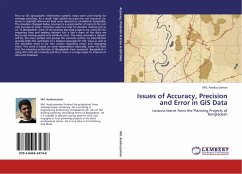
Issues of Accuracy, Precision and Error in GIS Data
Lessons learnt from the Planning Projects of Bangladesh
Versandkostenfrei!
Versandfertig in 6-10 Tagen
39,99 €
inkl. MwSt.

PAYBACK Punkte
20 °P sammeln!
Prior to GIS (geographic information system), maps were used mainly for strategic planning. As a result, high spatial accuracy was not required. So, errors in spatially referenced data were ignored or considered acceptable. The situation changed today. Accuracy is a great matter of concern for not only increase of land s monetary value but also for decision making and so on. In Bangladesh, most of the physical planning projects are using GIS for preparing map and making decision but a lion s share of the data are inaccurate having spatial and attribute error. The more accurate a dataset will b...
Prior to GIS (geographic information system), maps were used mainly for strategic planning. As a result, high spatial accuracy was not required. So, errors in spatially referenced data were ignored or considered acceptable. The situation changed today. Accuracy is a great matter of concern for not only increase of land s monetary value but also for decision making and so on. In Bangladesh, most of the physical planning projects are using GIS for preparing map and making decision but a lion s share of the data are inaccurate having spatial and attribute error. The more accurate a dataset will be, the more perfect and precise the outcome will be. As imperfection severely limits the usefulness of a dataset especially for GIS, users as well as the specialists need to be very careful regarding errors and managing them. This work is based on some observations especially, some GIS data that the planning authorities of Bangladesh have prepared. Bangladesh is using GIS until very recentlyand thus, there is a huge scope to improve its data and database.


