Nicht lieferbar
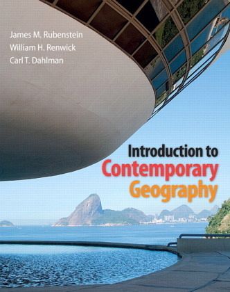
Introduction to Contemporary Geography Plus MasteringGeography with eText -- Access Card Package, m. 1 Buch, m. 1 Online
Versandkostenfrei!
Liefertermin unbestimmt
105,99 €
inkl. MwSt.
With an innovative integratio Product Description
ALERT: Before you purchase, check with your instructor or review your course syllabus to ensure that you select the correct ISBN. Several versions of Pearson's MyLab & Mastering products exist for each title, including customized versions for individual schools, and registrations are not transferable. In addition, you may need a CourseID, provided by your instructor, to register for and use Pearson's MyLab & Mastering products.
Packages
Access codes for Pearson's MyLab & Mastering products may not be included when purchasing or renting from companies other than Pearson; check with the seller before completing your purchase.
Used or rental books
If you rent or purchase a used book with an access code, the access code may have been redeemed previously and you may have to purchase a new access code.
Access codes
Access codes that are purchased from sellers other than Pearson carry a higher risk of being either the wrong ISBN or a previously redeemed code. Check with the seller prior to purchase.
--
With an innovative integration of visuals, text, and spatial graphics, Introduction to Contemporary Geography presents a modular and highly graphical springboard to introductory geography–ideal for contemporary students and learning styles. This innovative new resource partners best-selling human geography author Jim Rubenstein with environmental and physical geographer Bill Renwick, economic/political/cultural geographer Carl Dahlman, and the information architects at Dorling Kindersley (DK). The authors’ approachable prose and DK’s bold visual style combine to engage students with little to no science background, encouraging them to become scientifically literate and responsible consumers, readers, and voters. Features + Benefits
The unique DK-style format provides unparalleled clarity while adding excitement to tried and true, first-rate geographic analysis. The book's brief format features carefully selected topics that provide a springboard to each individual professor's introduction to geography course.
Every page contains integrated visuals, text, and spatial graphics, using multiple dimensions and representations most appropriate for the concept at hand. Every key concept has been developed and written around key graphics, allowing the visuals to do much of the work.
The book's modular organization consists of chapters made up of self-contained two-page spreads, a reliable presentation that offers the instructor flexibility when assigning material to students.
Every chapter opens with Key Questions, which are then used as the framework for each two-page module within the chapter.
These Key Questions ask students to take a bigger picture approach to the concept, and they often apply to two or more modules. Students should be able to answer the Key Question presented in each module after working through it.
Each module also presents two unique Main Points that students should understand after reading the module. The Key Questions and Main Points are revisited in the end of chapter Review. This structured learning path guides students through a text that is both visually engaging and conceptually challenging.
The end-of-chapter Review includes:
a summary of Key Questions and the associated Main Points from all modules in the chapter
Thinking Geographically critical-thinking questions
MapMaster Interactive Mapping activities
Google Earth Explore image analysis questions
On the Internet web links
Key Terms definitions
a Looking Ahead chapter preview section.
Current data incorporates the latest science, statistics, and associated imagery, including data from the 2010 Census and events like the political crisis in the Middle East and the Facebook phenomenon.
QR Codes on the chapter openers enable students to link smartphones from the book on the fly to various open source geography websites relevant to each chapter, giving students easy and immediate access to original sources and up-to-date data. Please note: Users must download a QR code reader to their mobile phone. Data and roaming charges may also apply.
NEW! MasteringGeographyT from Pearson has been designed and refined with a single purpose in mind: to help educators create that moment of understanding with their students. The Mastering online homework and tutoring system delivers self-paced tutorials that provide individualized coaching, focus on your course objectives, and are responsive to each student's progress. The Mastering system helps instructors maximize class time with customizable, easy-to-assign, and automatically graded assessments that motivate students to learn outside of class and arrive prepared for lecture. By complementing their teaching with our engaging technology and content, instructors can be confident their students will arrive at that moment - the moment of true understanding. MasteringGeographyT:
Lets instructors easily assign automatically graded media activities
Gives students personalized coaching and feedback
Motivates students to come to class prepared
Easily captures data to assess learning outcomes
MasteringGeography program features include:
MapMaster: Compelling interactive mapping media and assessments help engage students and test their critical thinking, geographic literacy, and spatial reasoning skills.
Encounter GoogleEarthTactivities: Encounter activities using Google EarthT supplement each chapter, for the most robust geobrowser support available.
Pearson eText: Pearson eText gives students access to the text whenever and wherever they can access the Internet. The eText pages look exactly like the printed text, and include powerful interactive and customization functions. This does not include the actual bound book.
Map Projections media: New geography interactive to help reinforce and remediate students on these basic but challenging Chapter 1 map projection concepts.
Instructor Resources: A new robust Instructor Resource Manual guides faculty through teaching from the book, along with advice and best practices for using Pearson and outside support material to maximize success teaching with the book.
Television for the Environment Geography videos with assessments.
Web links
Glossary flashcards
Inthe News RSS feeds
Chapter Quizzes
Thinking Spatially and Data Analysis activities
Critical Thinking questions
1. Thinking Geographically
2. Weather, Climate, and Climate Change
3. Landforms
4. Biosphere
5. Population
6. Migration
7. Languages and Religions
8. Political Geography
9. Development
10. Food and Agriculture
11. Industry
12. Services and Settlements
13. Urban Patterns
14. Resources
With an innovative integration of visuals, text, and spatial graphics, Introduction to Contemporary Geography presents a modular and highly graphical springboard to introductory geography - ideal for contemporary students and learning styles. This innovative new resource partners best-selling human geography author Jim Rubenstein with environmental and physical geographer Bill Renwick, economic/political/cultural geographer Carl Dahlman, and the information architects at Dorling Kindersley (DK). The authors' approachable prose and DK's bold visual style combine to engage students with little to no science background, encouraging them to become scientifically literate and responsible consumers, readers, and voters. The core textbook is supported by MasteringGeography(TM), which includes MapMaster(TM) interactive maps, Google Earth(TM) projects, geoscience animations, geography videos, and an optional Pearson eText.
Bei diesem Produkt handelt es sich um ein Bundle, bestehend aus einem Buch und einem digitalen Mehrwert.
Deshalb wird dieses Produkt auf der Rechnung mit 19% MwSt ausgewiesen.


