Hazard Map Assessment of Mount Merapi, Indonesia using remote sensing
Versandkostenfrei!
Versandfertig in 6-10 Tagen
24,99 €
inkl. MwSt.

PAYBACK Punkte
12 °P sammeln!
As the global population is predicted to reach 7 billion people by 2012, land pressures and rapid population growth is resulting in many more communities living within danger zones of natural hazards, a pattern particularly seen around volcanoes. This will emphasise the impact of volcanoes on populations using the example of Mount Merapi. Mount Merapi is heavily overdue a large-scale eruption which could potentially put over 1.1 million people at risk. This work begins with a review of published papers and a description of Mount Merapi's geological history, with a particular focus on its recen...
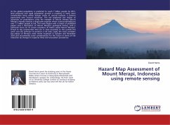
As the global population is predicted to reach 7 billion people by 2012, land pressures and rapid population growth is resulting in many more communities living within danger zones of natural hazards, a pattern particularly seen around volcanoes. This will emphasise the impact of volcanoes on populations using the example of Mount Merapi. Mount Merapi is heavily overdue a large-scale eruption which could potentially put over 1.1 million people at risk. This work begins with a review of published papers and a description of Mount Merapi's geological history, with a particular focus on its recent eruptions. To better assess Mount Merapi's threat to the communities that are in close proximity to the summit this work uses GIS software to produce a risk map. Lastly, the work considers the impact of Merapi's most recent eruptions in October and November 2010 and recommends some considerations for the future in terms of risk reduction by changes in response times and evacuation procedure


