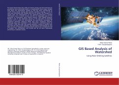
GIS Based Analysis of Watershed
Using Polar-Orbiting Satellites
Versandkostenfrei!
Versandfertig in 6-10 Tagen
37,99 €
inkl. MwSt.

PAYBACK Punkte
19 °P sammeln!
The book demonstrates the utility of remote sensing and GIS techniques in prioritizing micro-watersheds based on morphometric basin shape coupled with slope and urbanization analysis to find the areas contributing to runoff. Since remote sensing data provide repetitive coverage, It can be used more effectively with multiple data sets to monitor the changes on a regular basis. The development of new advanced techniques in Spatial Information such as remote sensing and GIS are effectively used for the extraction of information about spatial features. DEM (Digital Elevation Model) is one of the i...
The book demonstrates the utility of remote sensing and GIS techniques in prioritizing micro-watersheds based on morphometric basin shape coupled with slope and urbanization analysis to find the areas contributing to runoff. Since remote sensing data provide repetitive coverage, It can be used more effectively with multiple data sets to monitor the changes on a regular basis. The development of new advanced techniques in Spatial Information such as remote sensing and GIS are effectively used for the extraction of information about spatial features. DEM (Digital Elevation Model) is one of the important sources in the extraction of drainage network and is useful for determining the quantitative description of catchment geometry. Different DEMs have been compared, different landforms have been identified in the Vishwamitri watershed based on CartoSAT-1 DEM data with 30m spatial resolution, Landsat 8 Satellite data and with the help of GIS software. GIS techniques characterized by very high accuracy of mapping and measurement prove to be a competent tool in analysis. The prioritization was carried out for 42 micro watersheds pertaining to Vadodara taluka.


