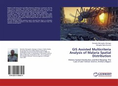
GIS Assisted Multicriteria Analysis of Malaria Spatial Distribution
Malaria Spatial Distribution and Risk Mapping: The Case of Jabi Tehinan District, Amhara Region
Versandkostenfrei!
Versandfertig in 6-10 Tagen
36,99 €
inkl. MwSt.

PAYBACK Punkte
18 °P sammeln!
Malaria is still among the top killing disease in Ethiopia, in general, and the study area in particular. This study was initiated with the central aim of mapping out malaria hazard and risk area within the district. So GIS is the best tool to map out by considering different parameters together.To produce a malaria hazard map; altitude, rainfall, temperature, river proximity, slope, and soil type were used while the distance from health service, land use type, and population density are the four parameters used to produce risk mapping. Meteorological data were collected from 13 meteorological...
Malaria is still among the top killing disease in Ethiopia, in general, and the study area in particular. This study was initiated with the central aim of mapping out malaria hazard and risk area within the district. So GIS is the best tool to map out by considering different parameters together.To produce a malaria hazard map; altitude, rainfall, temperature, river proximity, slope, and soil type were used while the distance from health service, land use type, and population density are the four parameters used to produce risk mapping. Meteorological data were collected from 13 meteorological stations.The last five-year malaria patients report showed that there is a dramatic increase of malaria patients in the study area which is different from the national annual report.


