- Broschiertes Buch
Andere Kunden interessierten sich auch für
![Java 9 Concurrency Cookbook, Second Edition Java 9 Concurrency Cookbook, Second Edition]() Javier Fernández GonzálezJava 9 Concurrency Cookbook, Second Edition56,99 €
Javier Fernández GonzálezJava 9 Concurrency Cookbook, Second Edition56,99 €![Raspberry Pi for Python Programmers Cookbook, Second Edition Raspberry Pi for Python Programmers Cookbook, Second Edition]() Tim CoxRaspberry Pi for Python Programmers Cookbook, Second Edition51,99 €
Tim CoxRaspberry Pi for Python Programmers Cookbook, Second Edition51,99 €![Postgis Cookbook Postgis Cookbook]() Thomas J. KraftPostgis Cookbook55,99 €
Thomas J. KraftPostgis Cookbook55,99 €![Mastering Qt 5 - Second Edition Mastering Qt 5 - Second Edition]() Guillaume LazarMastering Qt 5 - Second Edition51,99 €
Guillaume LazarMastering Qt 5 - Second Edition51,99 €![Deep Reinforcement Learning Hands-On - Second Edition Deep Reinforcement Learning Hands-On - Second Edition]() Maxim LapanDeep Reinforcement Learning Hands-On - Second Edition60,99 €
Maxim LapanDeep Reinforcement Learning Hands-On - Second Edition60,99 €![Scala Design Patterns, Second Edition Scala Design Patterns, Second Edition]() Ivan NikolovScala Design Patterns, Second Edition50,99 €
Ivan NikolovScala Design Patterns, Second Edition50,99 €![Clojure Data Analysis Cookbook- Second Edition Clojure Data Analysis Cookbook- Second Edition]() Eric RochesterClojure Data Analysis Cookbook- Second Edition62,99 €
Eric RochesterClojure Data Analysis Cookbook- Second Edition62,99 €-
-
-
Produktdetails
- Verlag: Packt Publishing
- Seitenzahl: 584
- Erscheinungstermin: 30. März 2018
- Englisch
- Abmessung: 235mm x 191mm x 32mm
- Gewicht: 1075g
- ISBN-13: 9781788299329
- ISBN-10: 1788299329
- Artikelnr.: 52422874
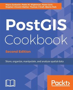
Mayra Zurbaran is a Colombian geogeek currently pursuing her PhD in geoprivacy. She has a BS in computer science from Universidad del Norte and is interested in the intersection of ethical location data management, free and open source software, and GIS. She is a Pythonista with a marked preference for the PostgreSQL database. Mayra is a member of the Geomatics and Earth Observation laboratory (GEOlab) at Politecnico di Milano and is also a contributor to the FOSS community.Pedro M. Wightman is an associate professor at the Systems Engineering Department of Universidad del Norte, Barranquilla, Colombia. With a PhD in computer science from the University of South Florida, he's a researcher in location-based information systems, wireless sensor networks, and virtual and augmented reality, among other fields. Father of two beautiful and smart girls, he's also a rookie writer of short stories, science fiction fan, time travel enthusiast, and is worried about how to survive apocalyptic solar flares.Paolo Corti is an environmental engineer with 20 years of experience in the GIS field, currently working as a Geospatial Engineer Fellow at the Center for Geographic Analysis at Harvard University. He is an advocate of open source geospatial technologies and Python, an OSGeo Charter member, and a member of the pycsw and GeoNode Project Steering Committees. He is a coauthor of the first edition of this book and the reviewer for the first and second editions of the Mastering QGIS book by Packt.Stephen Vincent Mather has worked in the geospatial industry for 15 years, having always had a flair for geospatial analyses in general, especially those at the intersection of Geography and Ecology. His work in open-source geospatial databases started 5 years ago with PostGIS and he immediately began using PostGIS as an analytic tool, attempting a range of innovative and sometimes bleeding-edge techniques (although he admittedly prefers the cutting edge).Thomas J Kraft is currently a Planning Technician at Cleveland Metroparks after beginning as a GIS intern in 2011. He graduated with Honors from Cleveland State University in 2012, majoring in Environmental Science with an emphasis on GIS. When not in front of a computer, he spends his weekends landscaping and in the outdoors in general.Bborie Park has been breaking (and subsequently fixing) computers for most of his life. His primary interests involve developing end-to-end pipelines for spatial datasets. He is an active contributor to the PostGIS project and is a member of the PostGIS Steering Committee. He happily resides with his wife Nicole in the San Francisco Bay Area.

