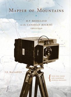
Between 1902 and 1930, Dominion Land Surveyor Morrison Parsons Bridgland spent nearly every summer mapping the mountains of Alberta and British Columbia, climbing many of Canada's Rocky Mountains for the first time. This unheralded alpinist perfected phototopographical techniques to compile a series of mountaintop photographs to create accurate topographical maps. Early tourists used his maps to explore the natural wonders of the eastern Rockies, and his book, Description of & Guide to Jasper Park (1917), told them what to go and see. In 1915, just over a century after David Thompson and his brigade made their way up to Athabasca Pass and over to the Pacific Slope, Bridgland brought his unmatched skills as a surveyor to this area-Jasper Park. How he made his photographs from the tops of mountains and even developed them while camped out in the wilderness are detailed in this biography, as are some of the trials and tribulations involved in that summer's survey. Mapper of Mountains also relates his involvement in the establishment and early years of the Alpine Club of Canada. Bridgland left an enduring legacy to future generations researching the ecological history of Jasper National Park, Waterton Lakes National Park, and other regions of the Rockies with his photographs and maps. In 1997, the Rocky Mountain Repeat Photography Project began systematically rephotographing Jasper National Park from all ninety-two of the mountain peak stations that Bridgland chose for his photographs so long ago, and then studying the ecological changes and constants. Today, work continues in Waterton Lakes National Park. One Last Photograph On 13 October 1915, M.P. Bridgland stood on a small cliff on the north side of the Miette River. Facing east towards the town of Jasper and his base camp, he exposed the final photographic plate for the survey of Jasper Park that he had been working on for a full summer. He conducted the survey as part of his normal summer work for the Dominion Lands Survey. This particular summer's work had required 735 photographic plates. Although an end had finally come to more than one hundred days of climbing mountains to establish ninety-two photograph stations, the survey had arrived only at the end of the work needed to be done in the mountains and valleys. Now it was time for Bridgland to trade in his boots, ice axe, transit, and twenty-pound camera for drafting pencils and tracing linen. Making a map from all the photographs was the ultimate goal. I . S. MacLaren teaches in the Department of History and Classics and the Department of English at the University of Alberta. Professor MacLaren's particular interests in environmental history and Jasper National Park grew out of the upper Athabasca River valley's role as part of the transcontinental fur trade route during the first half of the nineteenth century. "Researching M.P. Bridgland let me extend my interest in the valley into the twentieth century and into the history of national parks in the Rockies and beyond." Eric Higgs is Professor and Director of the School of Environmental Studies at the University of Victoria, and Principal Investigator of the SSHRC-funded Rocky Mountains Repeat Photography project. The RMRPP "allowed me to get out in the field working on issues that matter to me: landscape change, ecological restoration, and protected areas management, and more recently the art and science of repeat photography and the creation of visual narratives about landscape." Gabrielle Zezulka-Mailloux has her doctorate from the University of Alberta, where she teaches in the Department of English. Perceptions of wilderness in literatures and legislation pertaining to the Rocky Mountains are a focus of her interest in the environment and literature. As a research assistant on the RMRPP, she joined others on "wild-goose chases through mountains of dusty letters, ledgers, reports, and maps," and eventually to Bridgland's glass plate negatives.


