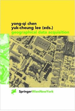
This book is dedicated to the theory and methodology of geographical data acquisition, providing comprehensive coverage ranging from the definition of geo-referencing systems, transformation between these systems to the acquisition of geographical data using different methods. Emphasis is placed on conceptual aspects, and the book is written in a semi-technical style to enhance its readability. After reading this book, readers should have a rather good understanding of the nature of spatial data, the accuracy of spatial data, and the theory behind various data acquisition methodologies. This volume is a text book for GIS students in disciplines such as geography, environmental science, urban and town planning, natural resource management, computing and geomatics (surveying and mapping). Furthermore it is an essential reading for both GIS scientists and practitioners who need some background information on the technical aspects of geographical data acquisition.
This is a book about techniques used in the acquisition of geographical data. The target audience is students and professionals using geographical information systems who want to go beyond the operation of the software and discover the general principles of how raw geographical data are acquired. By "raw" data we mean da ta acquired directly from the field, from photographs, or from maps but wh ich has not been edited or structured for database storage. With this in mind, we have placed a heavier emphasis on geo-referencing and data acquisition techniques, making the co ordinate reference framework an important link tying the chapters together. In writing thisbook, we have adopted a Scientific American-type style, which appeals to the technically curious layperson. This is more than just a collection of artides, this is a textbook written jointly by several people. The co ordination required for such an approach has made the production of this book much more difficult. The authors are predominantly faculty members of the Department of Land Surveying and Geo-Informatics at The Hong Kong Polytechnic University. We had hoped that this dose proximity of authors could help us better co ordinate the contents and ensure some consistency in style.
This is a book about techniques used in the acquisition of geographical data. The target audience is students and professionals using geographical information systems who want to go beyond the operation of the software and discover the general principles of how raw geographical data are acquired. By "raw" data we mean da ta acquired directly from the field, from photographs, or from maps but wh ich has not been edited or structured for database storage. With this in mind, we have placed a heavier emphasis on geo-referencing and data acquisition techniques, making the co ordinate reference framework an important link tying the chapters together. In writing thisbook, we have adopted a Scientific American-type style, which appeals to the technically curious layperson. This is more than just a collection of artides, this is a textbook written jointly by several people. The co ordination required for such an approach has made the production of this book much more difficult. The authors are predominantly faculty members of the Department of Land Surveying and Geo-Informatics at The Hong Kong Polytechnic University. We had hoped that this dose proximity of authors could help us better co ordinate the contents and ensure some consistency in style.

