Environmental Remote Sensing and GIS in Iraq
-
- Hardcover ausgewählt
- Taschenbuch
- eBook
-
Sprache:Englisch
97,99 €
inkl. MwSt,
Lieferung nach Hause
Beschreibung
Details
Einband
Gebundene Ausgabe
Erscheinungsdatum
13.09.2019
Herausgeber
Ayad M. Fadhil Al-Quraishi + weitereVerlag
SpringerSeitenzahl
529
Maße (L/B/H)
24,1/16/3,5 cm
Gewicht
975 g
Auflage
1st ed. 2020
Sprache
Englisch
ISBN
978-3-030-21343-5
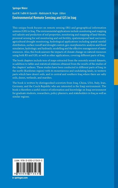
This unique book focuses on remote sensing (RS) and geographical information systems (GIS) in Iraq. The environmental applications include monitoring and mapping soil salinity and prediction of soil properties, monitoring and mapping of land threats, proximal sensing for soil monitoring and soil fertility, spatiotemporal land use/cover, agricultural drought monitoring, hydrological applications including spatial rainfall distribution, surface runoff and drought control, geo-morphometric analysis and flood simulation, hydrologic and hydraulic modelling and the effective management of water resources. Also, this book assesses the impacts of climate change on natural resources using both RS and GIS, as well as other applications, covering different parts of Iraq.
The book chapters include tens of maps extracted from the remotely sensed datasets, in addition to tables and statistical relations obtained from the results of the studies of the chapters' authors. These studies have been conducted in different parts of Iraq; in the north (Kurdistan region) with its mountainous and undulating lands, in western parts which have desert soils, and in central and southern Iraq where there are salty soils, dunes, wetlands, and marshes.
The book is written by distinguished scientists from Iraq, China, USA, Italy, Iran, Germany, and the Czech Republic who are interested in the Iraqi environment. The book is therefore a useful source of information and knowledge on Iraqi environment for graduate students, researchers, policy planners, and stakeholders in Iraq as well as similar regions.
Weitere Bände von Springer Water
-
Empty Buckets and Overflowing Pits von Roland Werchota
Roland Werchota
Empty Buckets and Overflowing PitsBuch
126,99 €
-
Water Resources Quality and Management in Baltic Sea Countries von Abdelazim M. Negm
Abdelazim M. Negm
Water Resources Quality and Management in Baltic Sea CountriesBuch
97,99 €
-
Estuaries and Coastal Zones in Times of Global Change von Kim Dan Nguyen
 - 12%
- 12%Kim Dan Nguyen
Estuaries and Coastal Zones in Times of Global ChangeBuch
139,99 €
160,49 €* -
Water Resources Management in Romania von Abdelazim M. Negm
Abdelazim M. Negm
Water Resources Management in RomaniaBuch
97,99 €
-
Water Resources Management in Balkan Countries von Abdelazim M. Negm
Abdelazim M. Negm
Water Resources Management in Balkan CountriesBuch
97,99 €
-
Environmental Remote Sensing and GIS in Iraq von Ayad M. Fadhil Al-Quraishi

Ayad M. Fadhil Al-Quraishi
Environmental Remote Sensing and GIS in IraqBuch
97,99 €
-
Management of Water Quality and Quantity von Martina Zelenakova
 - 15%
- 15%Martina Zelenakova
Management of Water Quality and QuantityBuch
126,99 €
149,79 €* -
Waste Management in MENA Regions von Abdelazim M. Negm

Abdelazim M. Negm
Waste Management in MENA RegionsBuch
97,99 €
-
Assessment and Protection of Water Resources in the Czech Republic von Martina Zelenakova
Martina Zelenakova
Assessment and Protection of Water Resources in the Czech RepublicBuch
97,99 €
-
Advances in Hydroinformatics von Philippe Gourbesville
 - 13%
- 13%Philippe Gourbesville
Advances in HydroinformaticsBuch
138,99 €
160,49 €* -
Floods and Long-Term Water-Level Changes in Medieval Hungary von Andrea Kiss
Andrea Kiss
Floods and Long-Term Water-Level Changes in Medieval HungaryBuch
116,99 €
-
Hydrology in a Changing World von Shailesh Kumar Singh
Shailesh Kumar Singh
Hydrology in a Changing WorldBuch
126,99 €
Unsere Kundinnen und Kunden meinen
Verfassen Sie die erste Bewertung zu diesem Artikel
Helfen Sie anderen Kund*innen durch Ihre Meinung
Kurze Frage zu unserer Seite
Vielen Dank für dein Feedback
Wir nutzen dein Feedback, um unsere Produktseiten zu verbessern. Bitte habe Verständnis, dass wir dir keine Rückmeldung geben können. Falls du Kontakt mit uns aufnehmen möchtest, kannst du dich aber gerne an unseren Kund*innenservice wenden.
zum Kundenservice